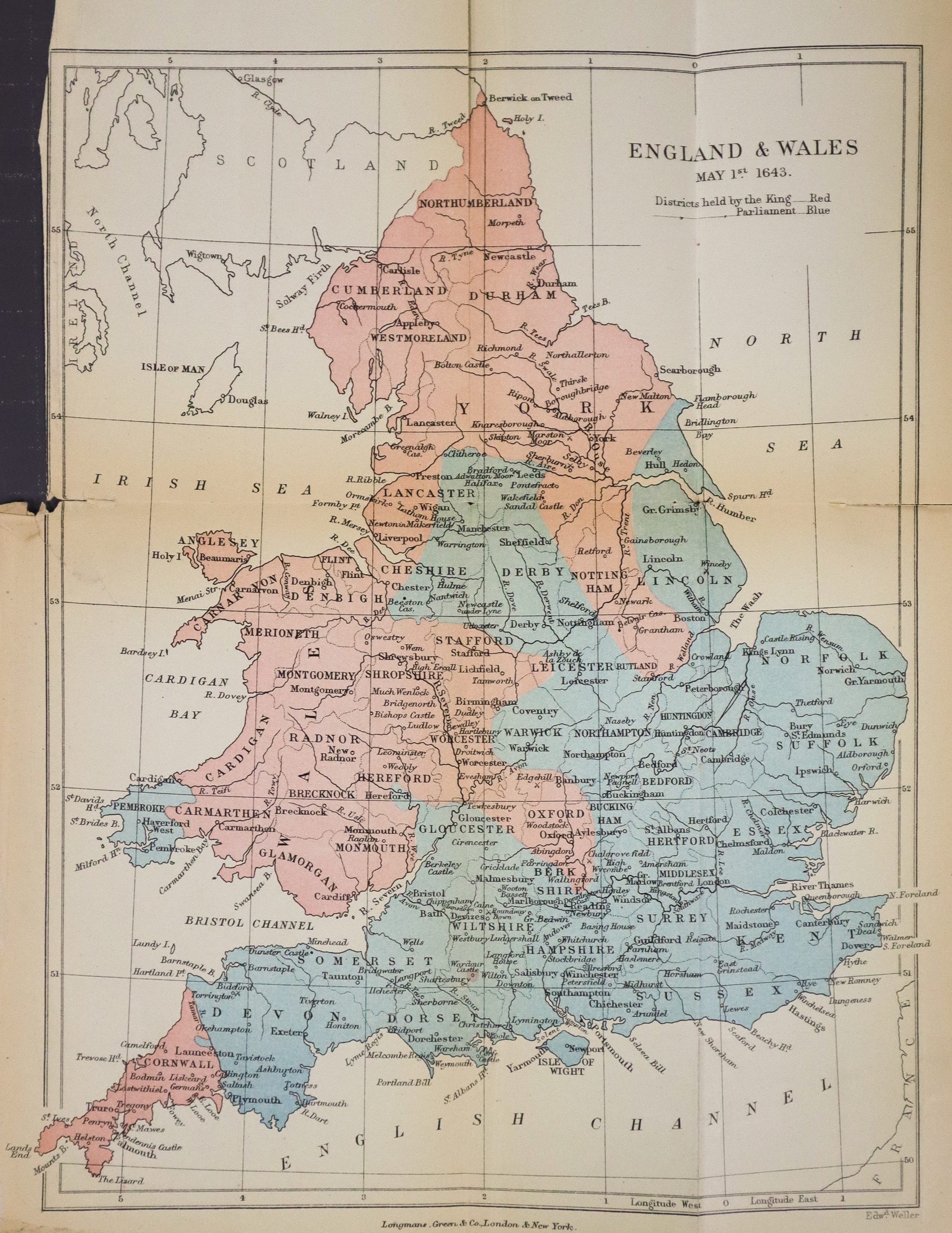
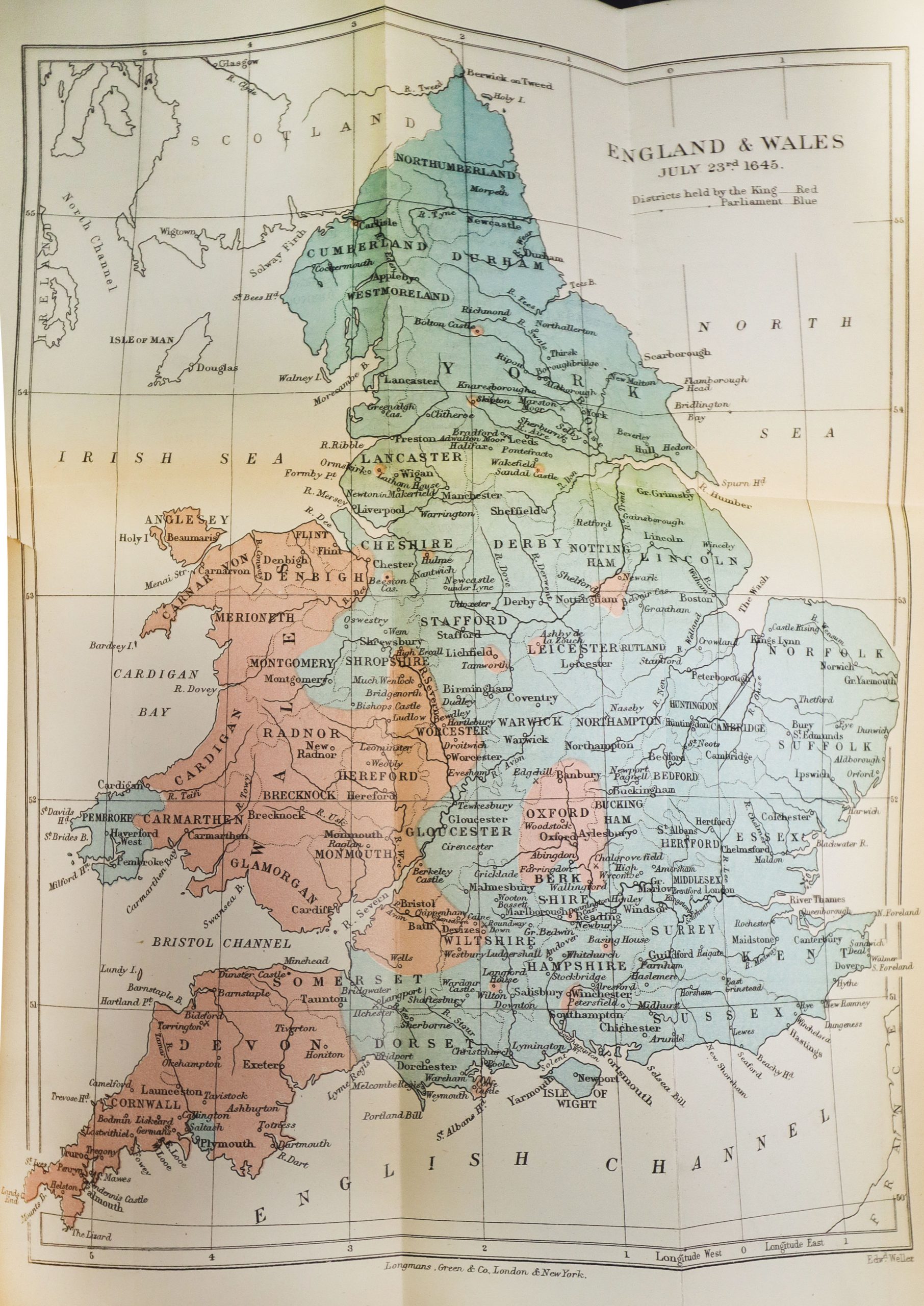
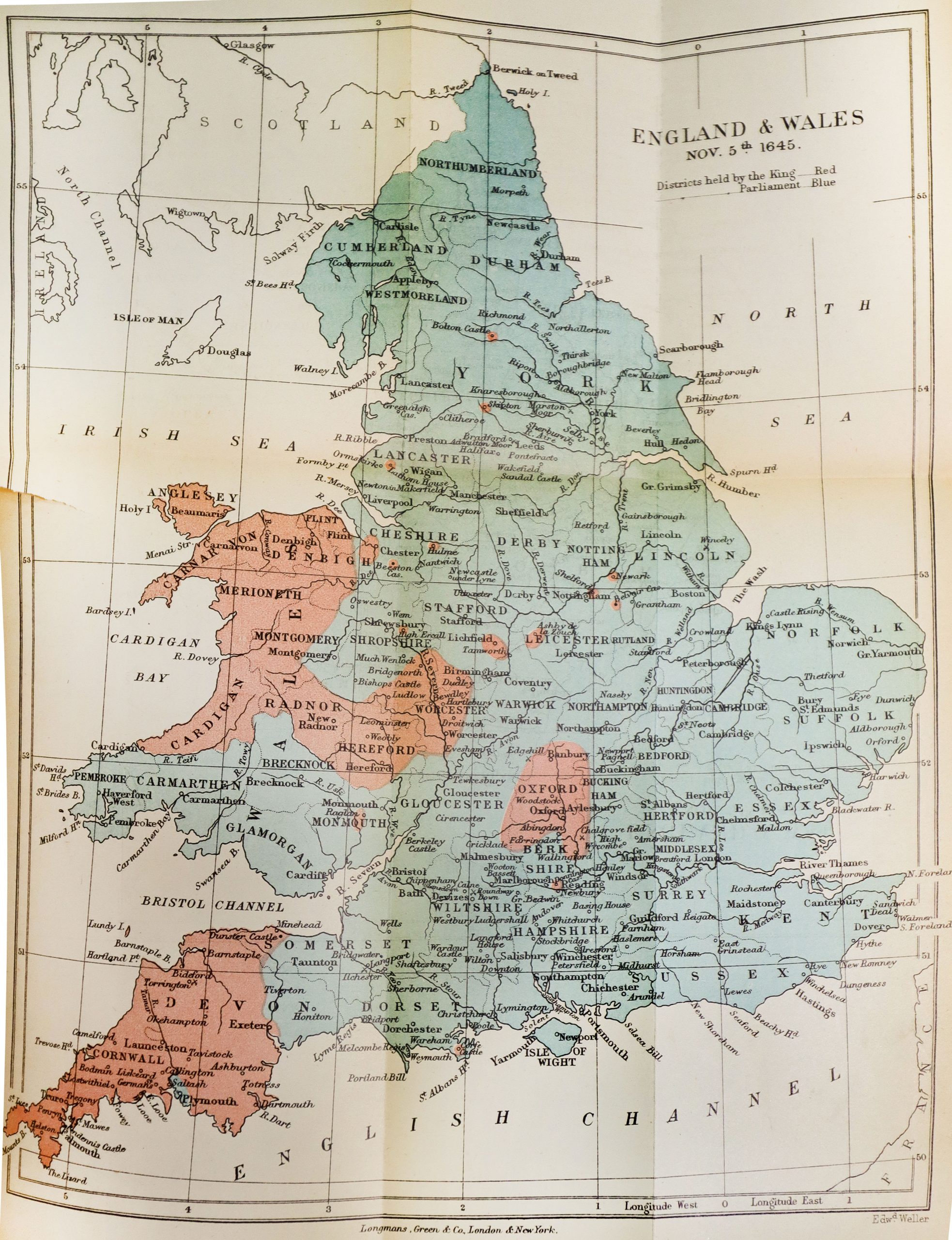
One thing that I have found that many military histories lack is good maps. This makes sense, as the skill it takes to make a high quality map don’t necessarily overlap with those of a good historian. During a recent visit to the British archives I happened to find these maps printed in History of the Great Civil War by Samuel Gardiner on the English Civil Wars. They are large fold out maps, the type that only make it into the scanned versions online if they’ve done a very careful job. This is something that I had unsuccessfully searched online for in the past, so I figured I would share them here to help out anyone else looking for the same thing. And I apologize for the quality of these, I was only able to take pictures rather than do proper scans.
No trip to Plymouth for a student of the Pilgrims is complete without a visit…
Knox General William Howe lowered his spyglass in astonishment. He could not believe what he…
Shackleton's ad, "Men Wanted for Hazardous Journey" is legendary (and unfortunately mythical). But this advertisement…
We would like to invite you to join us on our history tour this year…
Two rival churches at the foot of Plymouth's burial hill - a split between the…
Clark's Island was the first landing spot of the Pilgrims in Plymouth Bay. It remains…