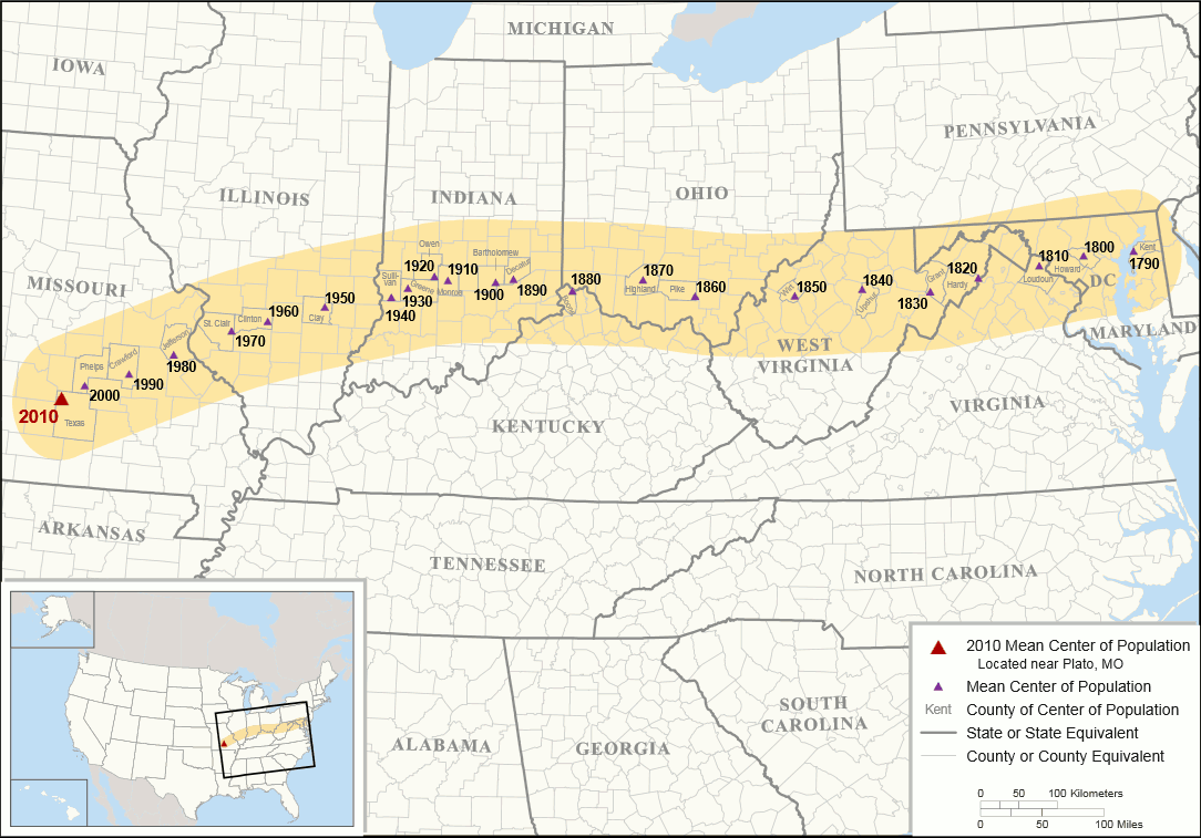
This map tracks the change the the mean center of population in the US – the point in the middle of the country in terms of population. You can see that the point has steadily shifted west from 1790, when it was nearly on the Maryland coast, to the present, when it is in Missouri Image from the United States Census Bureau.